Feeds:
Artigos
Comentários

Archive for the ‘GeoLiteracia’ Category

This map shows links between a few countries concerning scientific collaborations. This spatial pattern is also visible in many other datasets (namely the Facebook connections map). It shows that globalization isn’t always the rule. In the case of scientific collaborations, “global” means a minority of countries.
Notice that shorelines are not present in this map, although we can inferred the shapes of the continents.

See more details in : http://collabo.olihb.com/
Read Full Post »

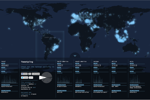
tweetping.net

The World according to tweeter. This is a snapshot of the World between 8:30 AM and 9:00 AM GMT. Excellent tool to study population distribution.

Go to
tweetping.net

Read Full Post »

Read Full Post »

Read Full Post »

Read Full Post »

What Can You Do With Geography? – National Geographic Education.

Read Full Post »

What is Geo-literacy? – National Geographic Education.

Read Full Post »

Geo-Literacy

Read Full Post »